Executive Director’s Message – June 2020

Somewhere southeast of Nueltin Lake, in the heart of Denesuline country above the treeline, the North Seal River commences from small creeks and lakes that interconnect to form the northern arm of the Seal River flowing southeast.
This river and the country around it was–and is still–used exclusively by the Denesuline people of Northlands Denesuline First Nation (Lac Brochet) and Sayisi Dene First Nation for navigation and harvesting.
Somewhere east of Reindeer Lake, deep in the forest east of Brochet, marks the beginnings of the South Seal River, which has been historically used exclusively by the Woodland Cree of Barren Lands First Nation (Brochet) and O-Pipon-Na-Piwin Cree Nation (South Indian Lake) for navigation and harvesting. This river flows northeast from its origin.
Near the confluence of these river arms, the people of Sayisi Dene First Nation reside at Tadoule Lake.
Where the northern and southern arms of this river meet (twelve miles east of Tadoule) is Shethani Lake. It is from here that the Seal River proper flows unimpeded into Hudson Bay.

Shethani Lake Esker is an ancient stop-over point for Sayisi Dene. It was at this point where Dene birchbark canoes were made to cross the Seal River, enroute to the Stone Fort (later known as Churchill). It is also at this point that harbor seals are usually seen in large numbers, giving the river its name, and henceforth all the way to the coast.
I have felt the power of this huge volume of water when I entered the main artery of this river on a canoe.
There are no more lakes between Shethani Lake and Hudson Bay, just a wide, fast-moving river with ample whitewater for over 200 kilometers.
At the mouth of the Seal River on Hudson Bay is an area used historically and currently by both the Inuit of Kivilliq region and the Sayisi Dene of Tadoule Lake for hunting and seasonal harvesting of Beluga whales and Arctic char.
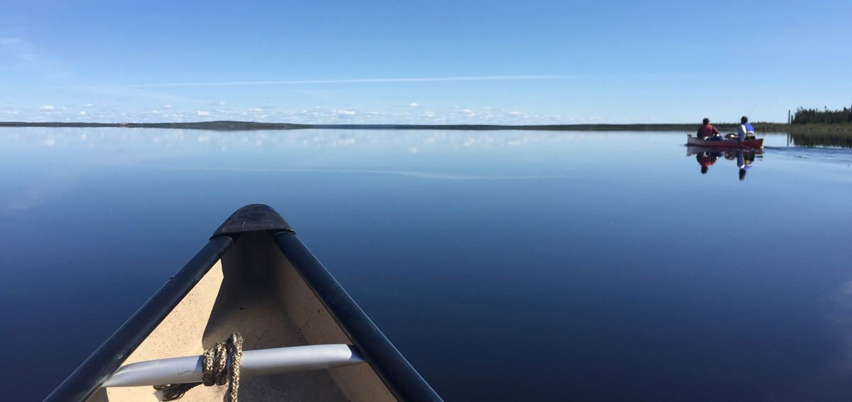
The view from Ernie Bussidor’s canoe on the Seal River in 2017.
Five Indigenous communities with three distinct cultures are working together with a common purpose and in harmony to create an Indigenous Protected Area.
Our goal is to protect our watershed from industrial development: to leave it in its pristine state for future generations to enjoy.
This initiative is a unique opportunity for us to pass on our knowledge, history and culture to our youth. It will also allow us to showcase our cultural richness and diversity and this incredible, pristine wilderness to the outside world.
Environment and Climate Change Canada (ECCC) is in support of our initiative and has contributed financially towards this project.
How we proceed — how we shape this protected area — is ours to decide.
On the scientific side, this is an amazing opportunity to protect and monitor the quality of water along with the fish and animals and plants that make this watershed their home.
Caribou, the mainstay food resource of the surrounding communities, also winter in the watershed, and we must ensure their numbers remain healthy for future generations to carry on the tradition of life with our valuable food source.
Sayisi Dene First Nation, along with the full support of the surrounding alliance of Indigenous nations, wish to declare this watershed as an Indigenous Protected Area, and are prepared to discuss our aspirations with the governments of Canada and Manitoba, and to seek their partnership in developing the northern corner of the province.
Masi cho
Ernie Bussidor
Executive Director
Seal River Watershed Alliance

Sayisi Dene First Nation members cheer after climbing a steep rock hill during an epic canoe trip up the Seal River in 2017. L to R: Thomas Cutlip, Lennox Bussidor, Paul Ellis, Jedrick Thorassie, Kyle Clipping-Powderhorn, Dean Powderhorn, Trayvon Mowatt, Sandy Clipping-Powderhorn, and Tyler Bussidor. (Credit: Ernie Bussidor, SDFN)